NoCo Chris
  • Home
  • 2012 & 2013 TRs
    • 2012 Trip Reports >
      • UN 6674 'Triangulation Point'
      • Shipler Mountain/Trail Ridge
      • Storm Peak
      • Panorama Peak and Sugarloaf Mountain
      • Lookout Mtn/Horsetooth Pk
      • Thatchtop
      • Green Mountain and Chickaree Lake
      • UN 7432 'Kelly Flats Peak'
      • Mount Bierstadt and Sawtooth Ridge
      • UN 6176
      • Clark Peak
      • Prohibition Mtn, Pingree Hill, UN 8079, UN 9740
      • "The Sabre"
      • Moriah, Manhead, 8340, 8555, 8435
      • Desolation Peaks
      • Round Butte
      • Pole Hill
      • The Needles and Lumpy Ridge HP
      • Pine Ridge
    • 2013 Trip Reports >
      • Eagle Rock and UN 8220
      • Kenny Mountain
      • Deer Ridge East
      • UN 8820
      • Dark Mountain
      • Mount Dickinson
      • UN 11002
      • Little Matterhorn
      • Snowdrift Peak
      • Crystal Mountain Group
      • Cameron Peak
      • Copeland Mountain
      • 8300, 8161, 8140, Sheep Mountain
      • UN 7383
      • UN 9986 and UN 9634
      • UN 10100 and UN 10013
  • 2014 Trip Reports
    • Prospect Mountain and Checkerboard Rock
    • UN 6823 and 6176
    • Panorama Peak
    • Livermore Mountain and UN 6975
    • Round Mountain, UNs 8092 & 8310
    • Fairchild Mountain
    • DeCaLibron
    • Ramsay, Sugarloaf and Skull
    • Sheep Mountain and Rock
    • Laramie-Poudre Tunnel and UN 10060
  • 2015 Trip Reports
    • Storm Mountain
    • UN 6945
    • UNs 7231 and 6485
    • UN 7380
    • Turkey Roost
    • UNs 9460S, 9495 & 10088
    • Nokhu Crags
    • High Dune
    • San Luis Peak
    • Bald Mountains and Laramie Mtns. HP
    • Mount Ida, Chief Cheley Peak, UN 12820
    • Lookout Mountain and UN 10582
    • Hell Canyon
    • UN 10020
    • Palisade Mountain
  • 2016 Trip Reports
    • UN 6740
    • UNs 9166 and 8806
    • The Monastery
    • Lonetree Mountain
  • External Sites

Climbing the Mountains and Hills of Larimer County and Beyond
Picture

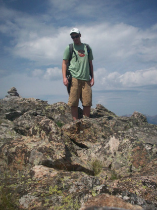
With over 500 recognized peaks spread across 2600 square miles, Larimer County is one of Colorado's most mountainous and diverse areas. It is my goal to climb each of these peaks at least once, but also to document some of the lesser visited areas that still remain wild despite the rapid growth of the Front Range cities. Few people have climbed all of Larimer's ranked peaks, and no one to my knowledge has ever climbed them all. 

In addition, I will provide selectively vague information about local mines, deposits and geologically interesting locations in the area, which is often ignored for more mineralized and profitable regions to the south. Eventually I will upload a gallery of some of my highest quality and most valuable finds, along with the other things that you can find if you know when to look at the ground closely. 

Contact me for route beta, clarifications, a climbing partner or whatever at ChrisSRoberts93@yahoo.com

You can also find me on the home of all peaks tall and obscure(Lists of John) and the year-round entertainment spectacle that are the 14ers forums. 

Some of my other climbing goals are:
-Climbing the 64 Colorado county highpoints
-Climbing all 14ers, ranked, named, unranked, unnamed, disputed and disowned. However many that might be...
-Visiting every named destination in Rocky Mountain National Park besides the peaks, and hiking every mile of trail within its boundaries
-Convince a marmot to come home and be my pet

Powered by Create your own unique website with customizable templates.